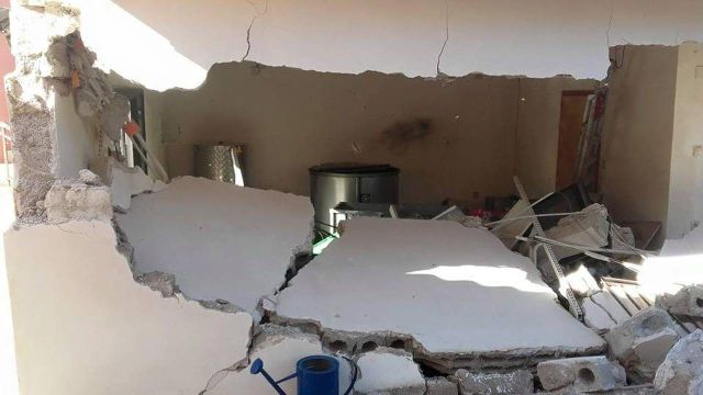
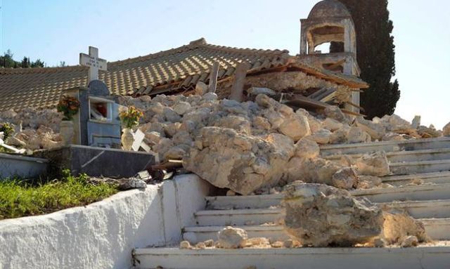
As is clear from the measurements carried out by the researchers at the National Observatory in Athens, the disastrous earthquake of 6.4 on the Richter scale has shifted the island 36 cm to the south, which is very impressive compared with the usual data. At the same time, the satellite images show that in addition to the horizontal displacement, in some places in Lefkada the crust has undergone vertical deformations reaching 20 cm, whereas the corresponding "sinking" in Athens after the earthquake in Parnitha in 1999 did not exceed 9 cm.
"The analysis of the data collected from the GPS station of the Institute of Geodynamics in Ponti, where a rock on the island of Lefkada killed a woman, shows that there is a 36 cm shift of land towards the island of Kefalonia. It is a big shift that is even surprising to us, scientists," seismologist and research director at the Institute of Geodynamics Athanassios Ganas, who is in charge of the matter, explains for the newspaper Ethnos.
"Do not forget that after the earthquake on the island of Kefalonia in January 2014, the shifts that we measured were of the order of 7 cm in Kipouria Monastery near Liksouri and 1.5 cm in our station in Valsamata. With the exception of this anomaly, we have established that the horizontal displacement is consistent with the fault that is oriented north to south and that aftershocks cannot change this picture because they do not release as much energy as the earthquake of 6.4 on the Richter scale."
The analysis of the Sentinel-1 satellite data of the European Space Agency carried out by BEYOND Centre of Excellence at the National Observatory in Athens is also indicative of the energy released during the last earthquake on the island. "The satellite images show a significant sinking of many centimetres in western Lefkada, reaching over 20 cm in some places in the satellite - Earth direction. Similar sinking has been established in the northern part of Kefalonia. The data will be subjected to further analysis for more accurate results," states Harris Kondoes, research director at the Institute of Astronomy, Astrophysics, Space Applications and Remote Sensing at the observatory.
1,000 aftershocks
"The soil deformation in Kefalonia is estimated at 7 cm," adds in turn Yiannis Papoutsis, researcher at the Athens Observatory. "Note that the vertical deformation in Athens in 1999 reached 8-9 cm and almost one metre during the earthquakes in Nepal in the spring of 2015. Of course, this depends not only on the magnitude of the earthquake but also on the mechanism that has generated it. In every case, learning how deformations occur as a result of earthquakes enriches our knowledge and help us better understand this phenomenon."
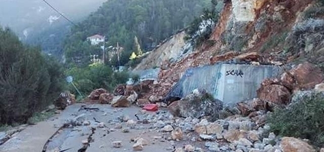
It should be noted that about 1,000 aftershocks have been recorded after the earthquake of 6.4 on the Richter scale on Tuesday, 17 November up until late last night, only 135 of which have been analyzed by the Institute of Geodynamics in Athens due to lack of staff. The analyses show that the secondary seismic activity is developing normally and that it is limited on the island of Lefkada, near the village Tsoukalades in the south and in the north of the island of Kefalonia.


