The geophysical survey and geological mapping of the Kasta mound in Amphipolis began on 11 November 2014 and was completed in stages because of poor weather conditions.
The research team involved Prof. Grigoris Tsokas, director of the Laboratory of Applied Geophysics of the Aristotle University of Thessaloniki who was in charge of activities, Prof. Panagiotis Tsourlos, Assoc. Prof. George Vargemezis, master students and other laboratory scientists. Sedimentology Assoc. Prof. George Siridis, Paleoseismology Prof. Spiros Pavlidis and geologist from the Ministry of Culture PhD Evangelos Kambouroglou took part in the process as well.
The study focus is the creation of a model of the soil from the era before human intervention and the construction of the dome. For this purpose, the team has carried out geological and tectonic observations and a number of electrical tomography studies. Both recent and earlier excavations have provided a field for monitoring and undeniable evidence of the location and characteristics of the geological formations.
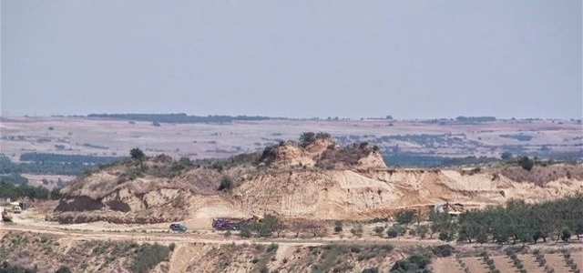
This stage has studied the subsoil around the dome of the mould, i.e. the north slope, and the terraces that have formed during the excavations in the eastern and western part. The survey was conducted using the method of electrical tomography and that of geo-radar scanning (also known as GPR - Ground Penetrating Radar) in a small place, due to the methodological limitations in the specific geological and archaeological conditions.
The study confirms the assumption that the hill has a mixed structure, and that its larger part is of natural origin whereas the anthropogenic embankments are a relatively small part. The dome seems to have been built in a trench dug into the slopes of an existing hill that now ends a few metres north of the dome.
The geophysical study has provided images of the inside of the hill, where it has detected the presence of antistatic structures that have been further studied. In one case, north of the dome, the removal of soil has revealed that the underground structure localized by electrical tomography is a natural sand formation. In the horizontal tomographic image at a height of 93 metres, the warm colours indicate areas with high specific resistance and cold colours those with low resistance.
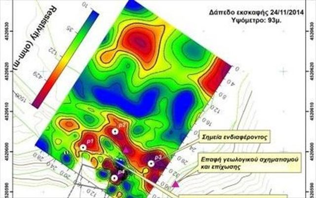
The white circles mark the "places of interest"
The tomography providing this image has been carried out on the surface, before the removal of soil. The places that require further study are indicated as "places of interest". The white line in the horizontal tomographic image is marked on the soil as well. It is clear that the deviation in the tomography scan is due to the sandy geological formation. It should be noted that the variations in the high levels of resistance, which can be seen in the northern part of the horizontal section, have not been examined because they are within the limits of natural formations.

Archaeologists will also study some other places detected by the survey.
The study of the hill will continue if weather conditions are suitable.


